Onshore Sabah, Malaysia
Integrated Prospectivity & Subsurface Study (IPSS), Onshore Sabah, Malaysia
Revealing the exploration potential of onshore Sabah through integrated multiphysics, satellite mapping, and petroleum geology
Covering approximately 65,000 km2 of structurally complex terrain across multiple geological basins, onshore Sabah remains one of the most data-sparse and underexplored onshore regions in Southeast Asia. Despite its proximity to prolific offshore petroleum systems, the area lacks modern subsurface characterization, with limited legacy 2D seismic coverage and sparse well control.
Designed to systematically evaluate the exploration potential of onshore Sabah, this multi-client Integrated Prospectivity and Subsurface Study (IPSS) integrates available geological, geophysical, and remote sensing data with new field observations and laboratory analyses. It provides the scientific foundation for informed exploration decision-making, including the identification and justification of locations for future 2D or 3D seismic acquisition.
The 18-month study integrates satellite mapping using Sentinel-1, Sentinel-2, and Copernicus DEM with Full-Tensor Gravity (FTG) reprocessing and 3D geological-geophysical modeling from the surface to the Moho, complemented by targeted fieldwork in collaboration with key academic institutions. A comprehensive laboratory program, including biostratigraphy, source rock, reservoir, and biomarker analyses, feeds into a three-phase integrated prospectivity review. Deliverables include play definition, sweet-spot identification, resource assessment, and ArcGIS-based digital geological maps to guide future exploration.
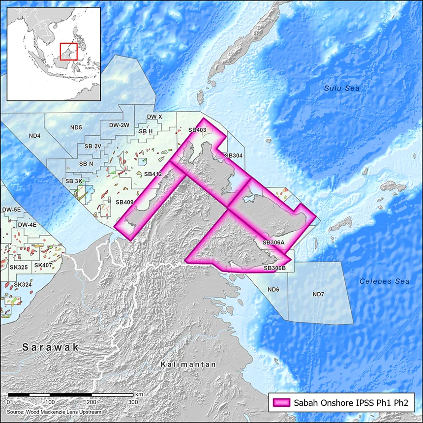
Explore available multi-client data using our interactive map.
Explore the Geostore