GHG Emission Monitoring
Unveiling hidden emissions with hyperspectral imaging
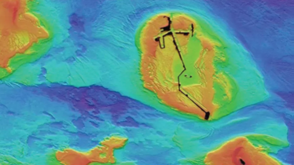
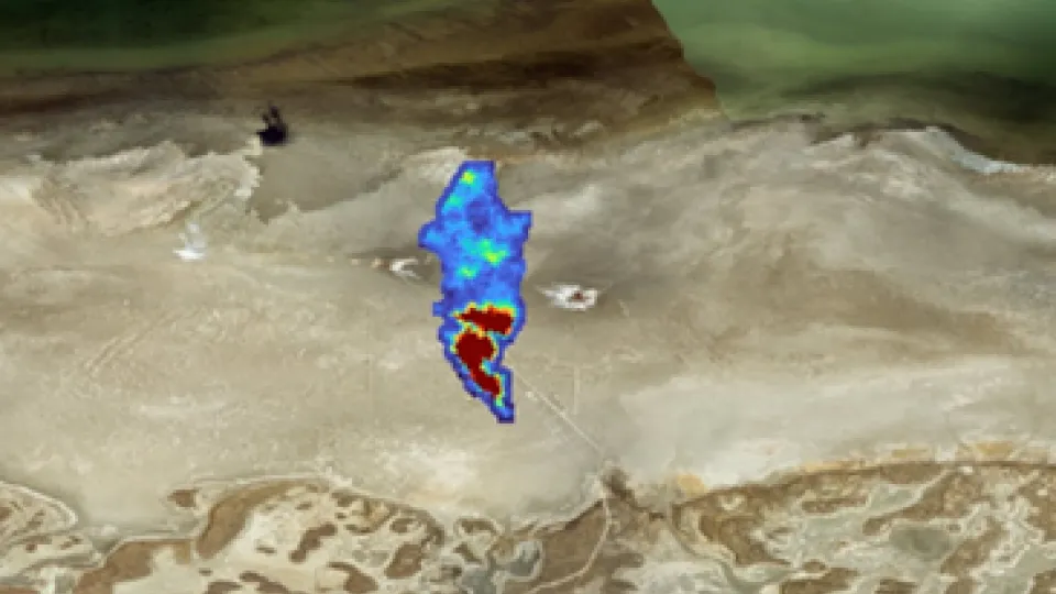
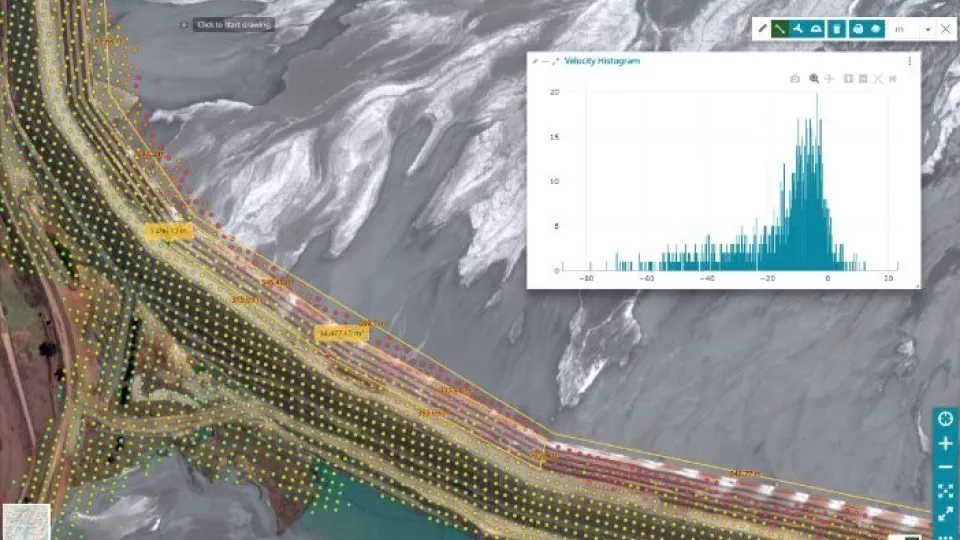
We utilize advanced hyperspectral satellite imagery to detect and analyze methane and other greenhouse gas emissions. By leveraging the unique absorption features of these gases, we identify emissions with high accuracy, even in challenging environments. Our sophisticated background noise modeling enhances detection, ensuring even subtle emissions are captured. This approach provides precise, actionable data for monitoring and reducing greenhouse gas emissions effectively.
Uncovering Weak Signals Missed by Conventional Methods
We detect specific absorption features of methane and other gases using hyperspectral imagery, filtering out background noise to enhance weak signals. This allows for precise detection, even in complex environments.
This technology is particularly valuable for industries where accurate emission monitoring and environmental compliance are critical, such as oil and gas, agriculture, and waste management. By capturing data across hundreds of wavelengths, we can precisely identify gas-phase plumes, even at low concentrations, and distinguish them from environmental noise. This comprehensive approach supports informed decisions for emission reduction, regulatory compliance, and sustainability goals.
GET IN TOUCH
Adaptable technology to suit your sector
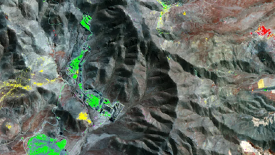
- Oil and Gas: Monitor methane emissions from pipelines, wells, and refineries to ensure compliance and reduce leaks, enhancing operational safety
- Agriculture: Detect methane from livestock operations and landfills, supporting sustainability and better management practices
- Waste management: Control methane emissions from landfills and wastewater treatment plants, optimizing biogas production
- Environmental monitoring: Track emissions from industrial activities and natural sources, contributing to climate change mitigation strategies
- Urban planning and public health: Identify emission hotspots in urban areas, supporting air quality and public health initiatives
- Regulatory compliance: Provide accurate, timely emission data to meet local, national, and international environmental reporting requirements
- Renewable energy: Optimize biogas production by monitoring methane concentrations, enhancing the efficiency of renewable energy generation
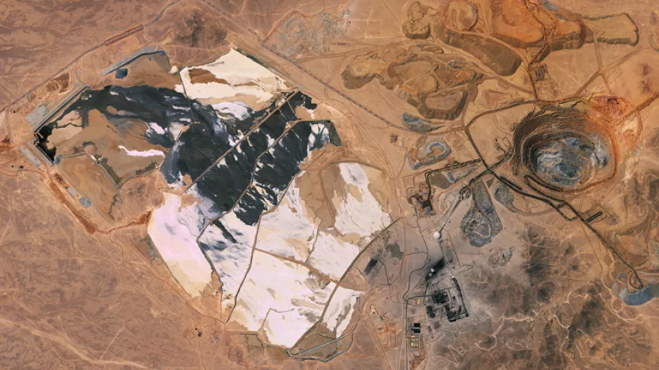
- Mining: Monitor methane levels to ensure worker safety and explore opportunities to capture methane as a resource
- R&D: Support climate research by providing detailed methane emission data, aiding in the development of mitigation technologies
- Insurance and risk management: Assess risks related to methane emissions, influencing policy premiums and coverage options
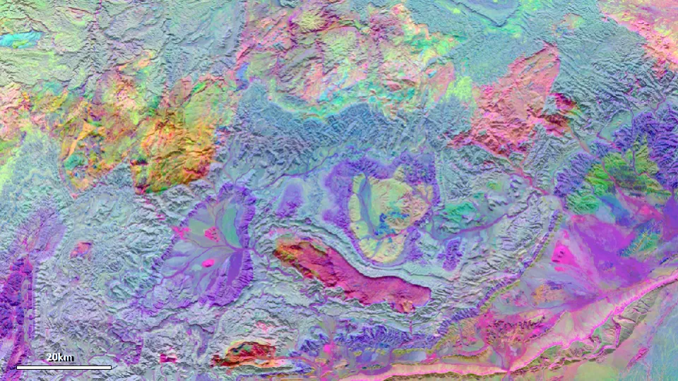
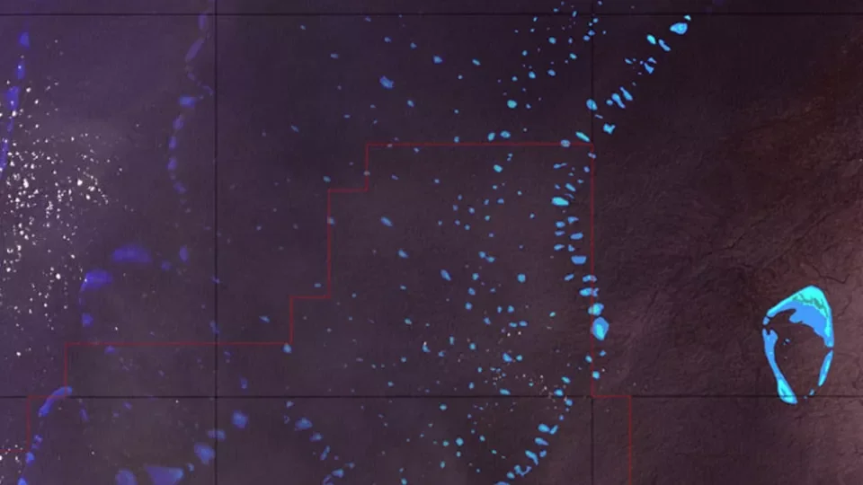
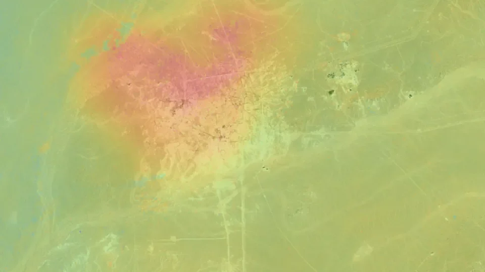
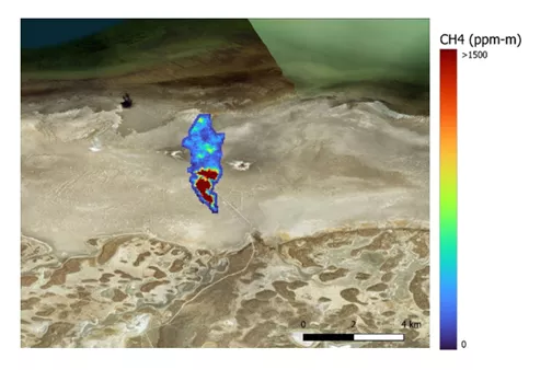
Image to the right shows methane anomalies above background levels. Estimated methane flux is shown by circle size, with larger radii indicating stronger emissions relative to background levels. The most significant anomalies appear as large red circles.