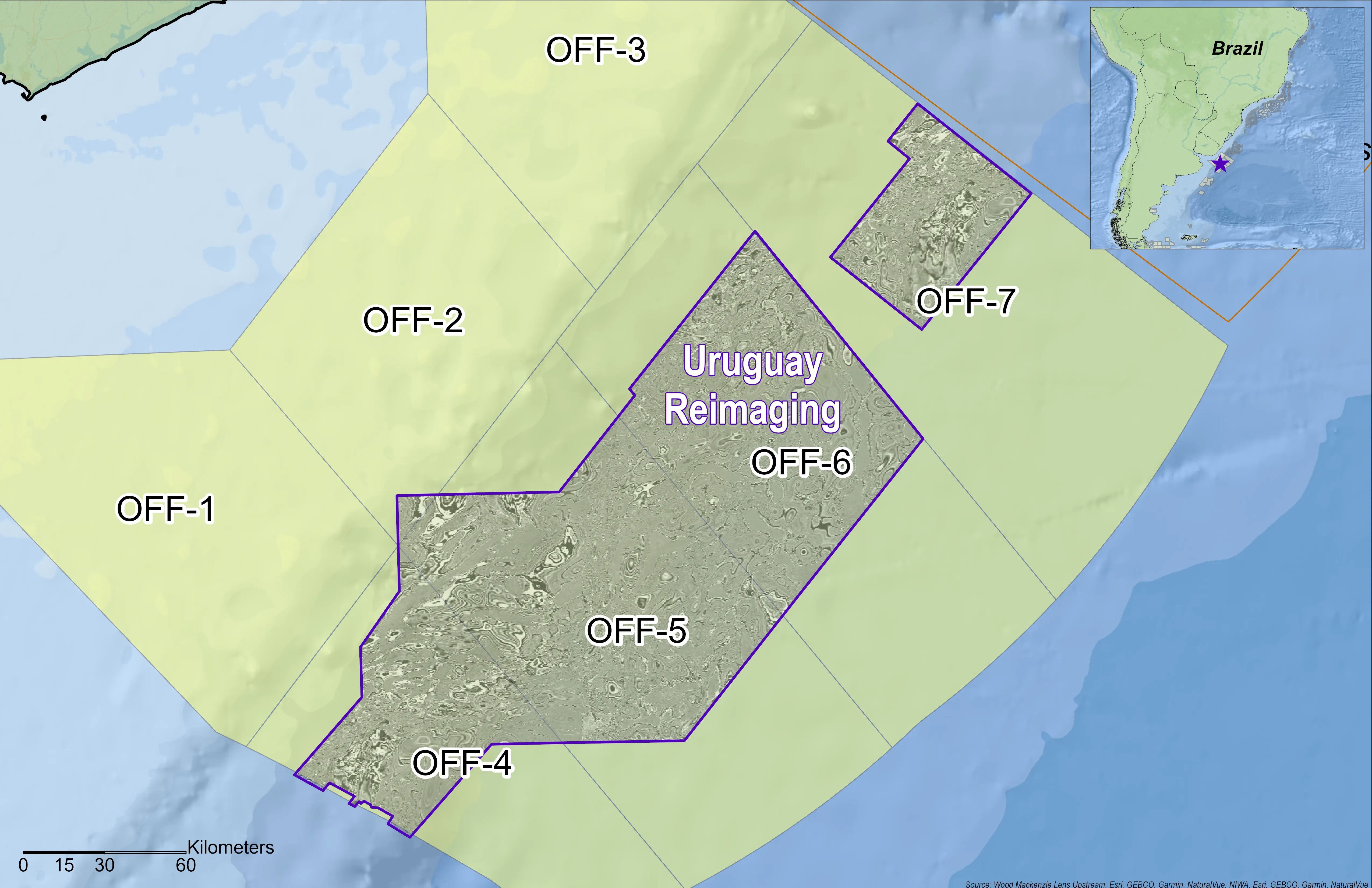
Uruguay, Atlantic Margin
Identify exploration risk and uncover new production targets with high-quality subsurface imaging
Recent discoveries offshore Namibia have renewed interest in the Uruguay conjugate margin, where comparable geological conditions are generating similar exploration plays.
Viridien has reimaged 25,000 km2 of legacy 3D seismic data offshore Uruguay using advanced imaging technologies, including Time-Lag Full-Waveform Inversion (TLFWI), to enhance data quality and reveal previously unseen deepwater features. Full-track least- squares KPSDM images are now available, providing clearer subsurface detail to support confident prospect evaluation.
Building on this momentum, our Charrua 3D multi-client survey is now underway, marking a major step forward in Uruguay's offshore energy development. This new acquisition expands Viridien's multi-client footprint and reflects strong industry confidence in the long-term potential of the southern Atlantic Margin.
Reducing geological uncertainty with advanced imaging
Still considered a frontier basin, deepwater Uruguay has similar geological elements at basin scale to Namibia’s high-potential Orange Basin, plus unique aspects at prospect scale that could help to achieve exploration success at Cretaceous stratigraphic levels. For more information, read our recent GeoExpro article: Exploring deeper in Uruguay: Could Namibia’s successful Cretaceous play be chased in Uruguay’s deepwater?
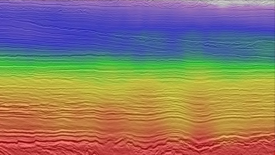
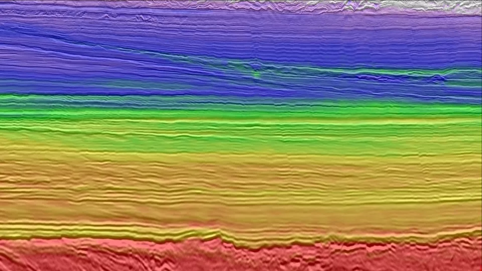
Legacy imaging (before) compared to reimaging using Viridien's advanced time-lag FWI imaging (after).
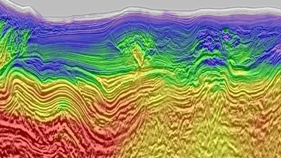
Video: Uruguay Offshore Reimaging
Reimaged data improves geological understanding of the progressive subsidence of the Uruguayan offshore margin, structure interpolation, and amplitude fidelity, thereby reducing exploration risk and generating potential new targets in this exciting frontier basin.
Related Technology & Surveys
Full-Waveform Inversion
Get highly detailed, data-driven models of subsurface velocity, absorption and reflectivity from full-waveform inversion (FWI).
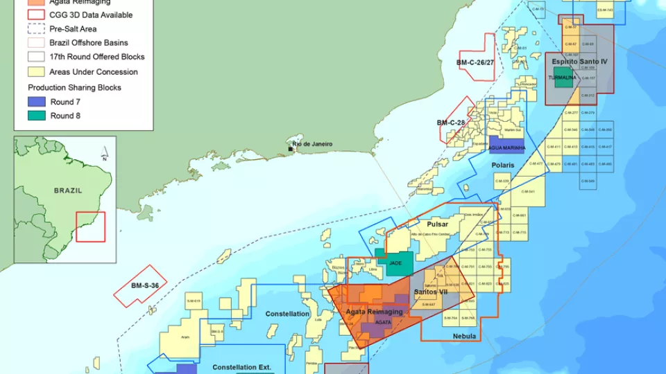
Santos and Campos Basins
Explore South America’s offshore pre-salt with high-quality, broadband, pre-stack depth migrated seismic data.
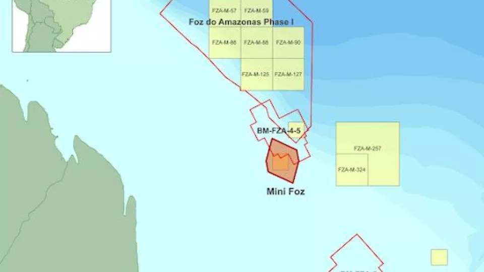
Foz do Amazonas
Gain a better understanding of geological potential with seismic datasets from the Foz do Amazonas Basin.
Explore available multi-client data using our interactive map
Explore the Geostore