Deepwater Offshore Suriname
Seismic insight for exploration and prospect evaluation
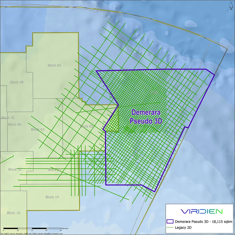
The Suriname–Guyana Basin is covered by extensive legacy 2D seismic, providing valuable regional context but often limiting structural continuity and detailed interpretation.
Viridien offers an integrated seismic data portfolio that supports exploration workflows from early basin screening through to prospect maturation, combining newly reprocessed deepwater Demerara Pseudo 3D seismic with high-quality reimaged 3D data.
Enhancing legacy 2D with Pseudo 3D imaging
Viridien’s deepwater Demerara Pseudo-3D reprocessing program transforms legacy 2D seismic surveys into a multi-directional interpretation volume, using ML-based enhancement to improve continuity and suppress high-frequency interpolation residuals. Designed as a time‑ and cost-effective solution, Demerara Pseudo-3D supports rapid screening of open acreage while refining regional geological understanding and prospect-scale interpretation.
Highlights:
- Approximately 18,000 km2 Pseudo 3D coverage
- Available now!
Legacy Regional Structure Map 
| Pseudo 3D Regional Structure Map 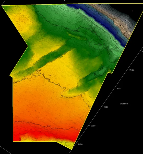
|
Comparison between 2D and Demerara Pseudo-3D at the near-Aptian level reveals additional structural details for regional and prospect evaluation. Our Demerara Pseudo 3D also provides a better geological perspective and interpretation of amplitude maps regarding reservoir attribute distribution.
Exploration-ready datasets
Supports screening, evaluation, and prospect maturation
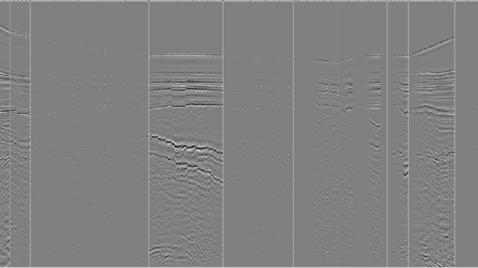
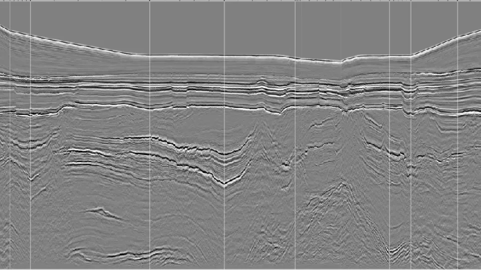
Demerara Pseudo 3D seismic section illustrating enhanced structural continuity and fault definition compared with legacy 2D data.
Advanced 3D seismic data for prospect maturation
Viridien’s 3D seismic data offshore Suriname supports detailed prospect evaluation and development studies. Advanced imaging workflows, including time lag full waveform inversion (TLFWI), enhance imaging of structural complexity and key geological features. In partnership with TGS and BGP, pre-stack depth migration (PSDM) processing has been completed over the shallow-water areas offshore Suriname, delivering high-quality imaging to support the maturation of stranded discoveries.
Key highlights
- Approximately 16,000 km2 of 3D seismic
- Final products available!
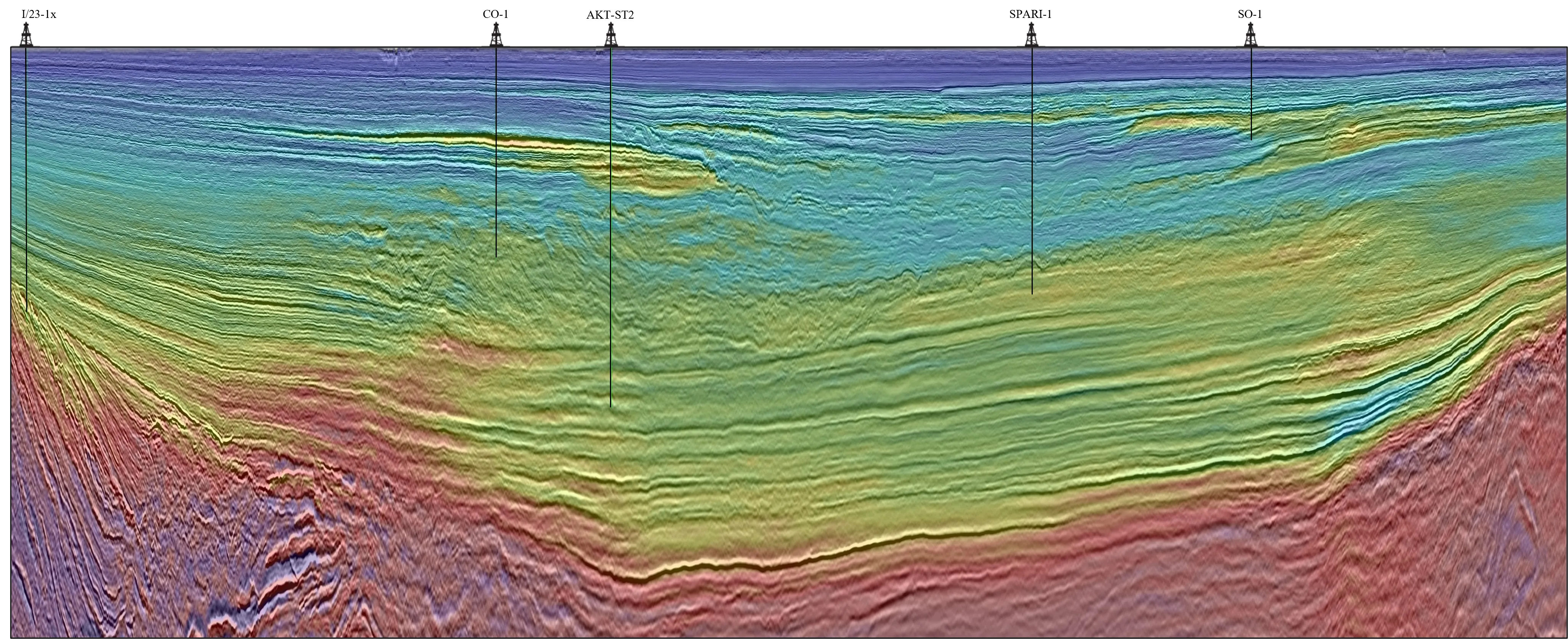
Fence line through reimaged Suriname 3D survey with overlying velocity layer.
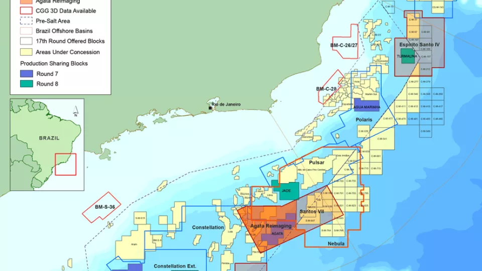
Santos and Campos Basins
Explore South America’s offshore pre-salt with high-quality, broadband, pre-stack depth migrated seismic data.
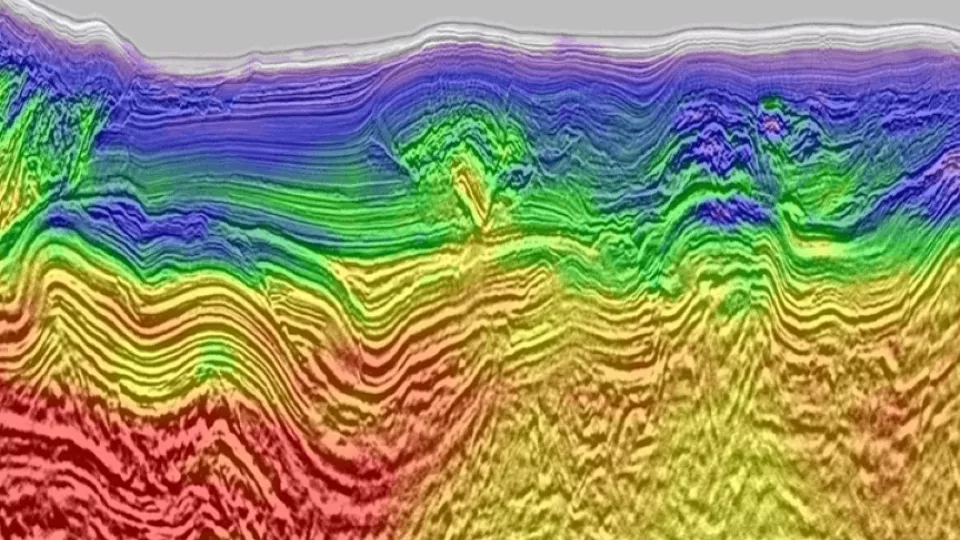
Full-Waveform Inversion
Get highly detailed, data-driven models of subsurface velocity, absorption and reflectivity from full-waveform inversion (FWI).
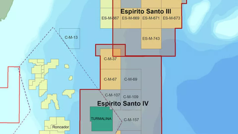
Espirito Santo
Access more than 22,000 km2 of high-quality 3D seismic data located at the southern end of the Espirito Santo Basin.
Explore available multi-client data using our interactive map
Explore the Geostore