Geolucent
Active hyperspectral sensing that delivers site-calibrated 3D geointelligence, operating remotely in total darkness and with multi-platform deployment
Mining teams must make high impact decisions under tight time constraints and limited visibility, especially underground, and in areas of unsupported ground. Conventional tools can fall short: assays may arrive late, RGB images and spot instruments provide limited information for daily mine operations.
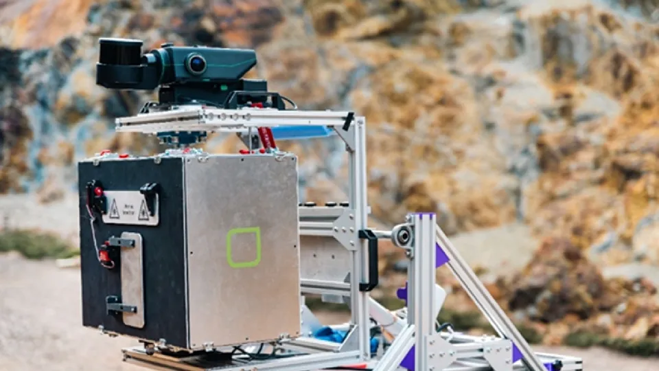
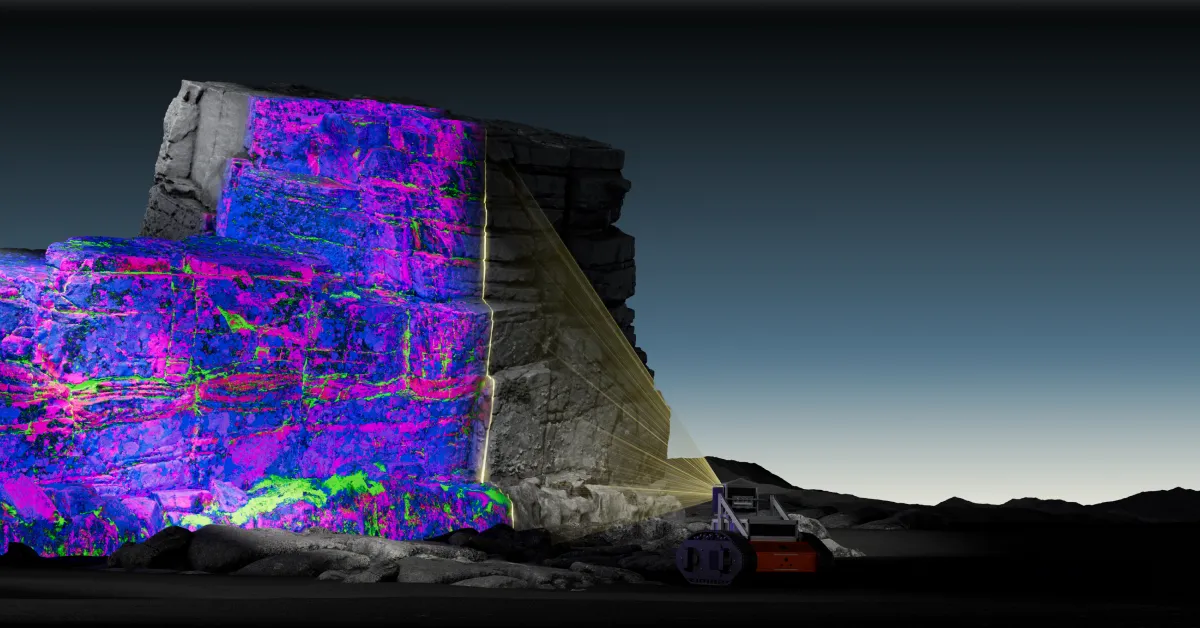
Geolucent is a developing innovation that addresses these shortcomings by delivering site-calibrated 3D geological intelligence that enables rapid, high confidence decision making. Designed to operate in complete darkness (24/7 underground setting or night pit scans), our prototype can be remotely controlled and mounted on multiple vehicle platforms for safer standoff operations.
Discover how Geolucent elevates decision-making on your site
The Geolucent prototype has been validated in mine environments and is undergoing further trials in active operations. We are now seeking industry partners who can support mine site access for week-long proof-of-value field trials to showcase our system value and integration potential for greater geological control.
Deliver actionable 3D geological insights
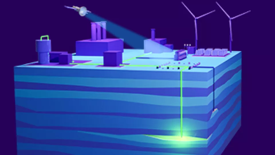
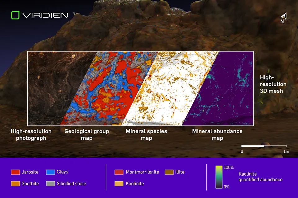
Geolucent outputs 3D attributes that delineate rock boundaries, mineral/alteration zones (e.g., clays, carbonates/sulfates, iron oxides), indications of ore/waste boundaries and hazard markers tied to geotechnical context. Each product includes confidence layers, QA/QC masks and complete data lineage to support auditability and reconciliation.
The attributes are polygonised and delivered in industry-standard file formats, enabling seamless integration with mine planning, dispatch and reconciliation systems.
Quantify mineralogy and geotechnical proxies, even in total darkness
Geolucent accelerates mine-site understanding with advanced sensing and processing technology:
- Laser-based illumination
- VNIR-SWIR hyperspectral camera
- LiDAR
- Edge-processing
- Spectral geological classification and Lidar geometry fusion
A 5*5m scene is acquired in 10 minutes with 3D geointelligence available 20 minutes after acquisition.