Peter Whiting interviewed by Upstream Online about Viridien’s Laconia sparse OBN survey

In an exclusive interview with Upstream Online, Peter Whiting, Head of Geoscience, explains how Viridien’s latest seismic technologies, such as full-waveform inversion and the Sercel Tuned Pulse Source (TPS), are delivering outstanding early-out results from its Laconia 3D OBN multi-client seismic program in the US Gulf.
“We're seeing things now that we wouldn't have believed that we could see 10 years ago,”
He also discusses the impact of seismic imaging improvements for industry decision-making and the importance of hiring the best people to help meet the industry’s technical challenges.
“With every project that we do, it's an opportunity to improve our technology. So you need the people that are capable of understanding the problem and working with R&D to find a way to improve the technology to solve that problem.”
Click here to read the original interview published by Upstream Online on 10th June 2025
Copyright: © Upstream Online
Viridien (www.viridiengroup.com) is an advanced technology, digital and Earth data company that pushes the boundaries of science for a more prosperous and sustainable future. With our ingenuity, drive and deep curiosity we discover new insights, innovations, and solutions that efficiently and responsibly resolve complex natural resource, digital, energy transition and infrastructure challenges. Viridien employs around 3,500 people worldwide and is listed as VIRI on the Euronext Paris SA (ISIN: 0013181864).
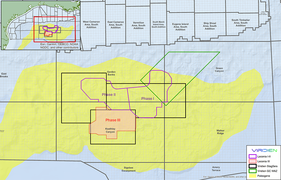
Continuing with the success of Phases I and II of its Laconia 3D OBN multi-client seismic program in the US Gulf, Viridien has announced, in collaboration with partner TGS, the start
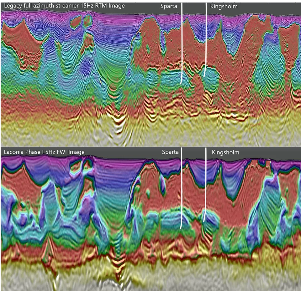
Laconia in the Garden Banks area of the US Gulf. Legacy full azimuth streamer 15 Hz RTM image overlaid with 6 Hz streamer FWI velocity (top) and Laconia Phase I long-offset low-frequency sparse OBN “early-out” 5 Hz FWI Image overlaid with corresponding velocity (bottom).The early-out image demonstrates significantly improved imaging of the salt and the deep basin architecture, including potential subsalt reservoir targets in the Paleogene trend. The seismic sections intersect the Sparta discovery and the Kingsholm prospect (a dry well with oil shows). More detailed images from Phase I and II will be delivered throughout 2025 and 2026, with final deliverables being released in Q2 2026. (Image courtesy of Viridien Earth Data).
Viridien (www.viridiengroup.com) is an advanced technology, digital and Earth data company that pushes the boundaries of science for a more prosperous and sustainable future. With our ingenuity, drive and deep curiosity we discover new insights, innovations, and solutions that efficiently and responsibly resolve complex natural resource, digital, energy transition and infrastructure challenges. Viridien employs around 3,400 people worldwide and is listed as VIRI on the Euronext Paris SA (ISIN: FR001400PVN6).