Sorry, you need to enable JavaScript to visit this website.
Menu
Login

Subsurface Imaging

Viridien wins contract to supply 30,000 Sercel WiNG land nodes to DMT

Publish Location
Paris, France
Body

Viridien announced today that its Sensing & Monitoring business line, marketed under the Sercel brand, has sold and delivered a total of 30,000 Sercel WiN
Publish Date
Image Caption
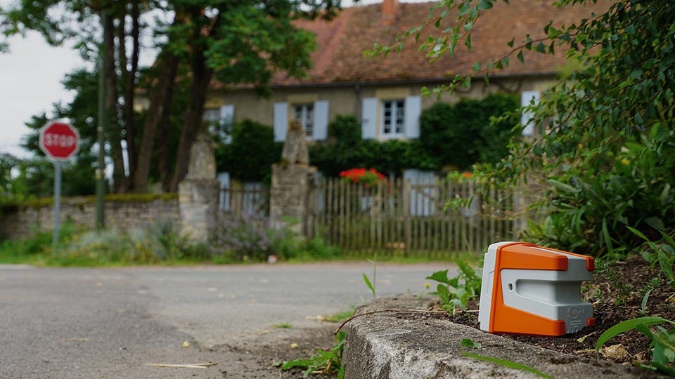
Featuring the ultra-sensitive broadband digital MEMS QuietSeis® sensor, the Sercel WiNG node delivers optimal data quality for outstanding subsurface imaging (image courtesy of Sercel).
Image
Image of a Sercel node on the floor into a street
Layout Canvas

Viridien authors of high-resolution FWI imaging paper recognized in 2024 SEG Awards

Publish Location
Paris, France
Tags
Body

Award-winning paper presents two case studies in which FWI imaging of data acquired with a source-over-spread design outperforms conventional imaging methods in terms of image resolution.

Viridien congratulates Isabel Espin, Nicolas Salaun, Hao Jiang and Mathieu Reinier on being recognize

Publish Date
Image Caption
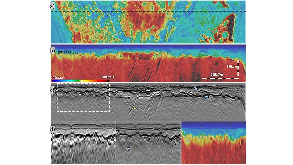
200 Hz FWI Imaging to study the top of salt and intra-salt intrusions. FWI velocity model at a depth of 400 m (a) showing strong lateral variations in velocity at the top of salt. FWI velocity (b) and reflectivity (c) in section view showing fast velocity features, suggesting anhydrite inclusions (green arrow) and carbonate build-ups (blue arrows). A comparison of the KPSDM, FWI Image and velocity model (d) reveals complex faulting structure (violet arrow) present above the salt body.

Image
Image showing 200 Hz FWI Imaging to study the top of salt and intra-salt intrusions.
Layout Canvas

High-frequency FWI Imaging: repurposing seismic data for imaging shallow hazards

Dedicated high-resolution site surveys are used to identify potential hazards prior to the placement of infrastructure. Apart from the additional acquisition expense, site surveys are often acquired as a series of 2D lines, which limits their spatial resolution. We describe how FWI Imaging results from existing, raw, conventional 3D seismic data, can be used as a rapidly available 3D alternative or supplementary dataset to help improve understanding of the shallow subsurface. Two case studies demonstrate the potential of this approach. Specifically, they show that high-frequency FWI and associated attributes can help to identify shallow anomalies and fault systems more effectively than standard imaging methods, with a significant increase in resolution. Furthermore, FWI has proven its ability to provide shallow image quality comparable to that of multibeam echo sounder measurements, even with less densely acquired data.